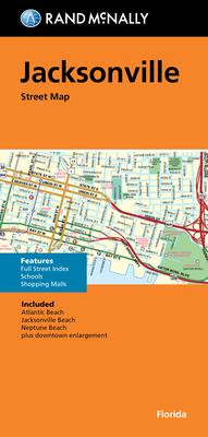
Navigate Jacksonville, Florida with ease using the Rand McNally Folded Map: Jacksonville. This expertly crafted map provides comprehensive coverage of the entire Jacksonville area, designed to meet the needs of travelers, residents, and professionals alike. It is a reliable companion for those looking to explore all corners of the city, whether on foot or by vehicle.
The map features detailed street information, including highways, main roads, and local streets, helping you find the best routes to your destinations. It includes essential information such as points of interest, parks, educational institutions, and business districts, making it an invaluable tool for tourists and locals. The folded design ensures that this map is both portable and easy to store, so you can carry it with you wherever you go.
Printed with high-quality materials, this Rand McNally map is made to withstand regular use. The clear and legible design ensures ease of reading, and the updated information guarantees accuracy and reliability. Whether you’re a visitor or a resident of Jacksonville, this map is your key to understanding the city's layout and discovering its hidden gems.